 |
| Hisley Bridge |
Continuing our walk from
Part 1, we soon arrived at the gate where Copperwood Rocks can be viewed from. These rocks while only covering a small area are huge.
 |
| Copperwood Rocks |
 |
| Copperwood Rocks |
A few seconds later was the entrance drive to Ide House and the tor of the same name can be found just inside it. Having been to the top of the tor before, we decided to enjoy the view from a few metres away; socially distancing! 😀
 |
| Ide House Tor, another outcrop noted by Tim Jenkinson |
 |
| Ide House Tor |
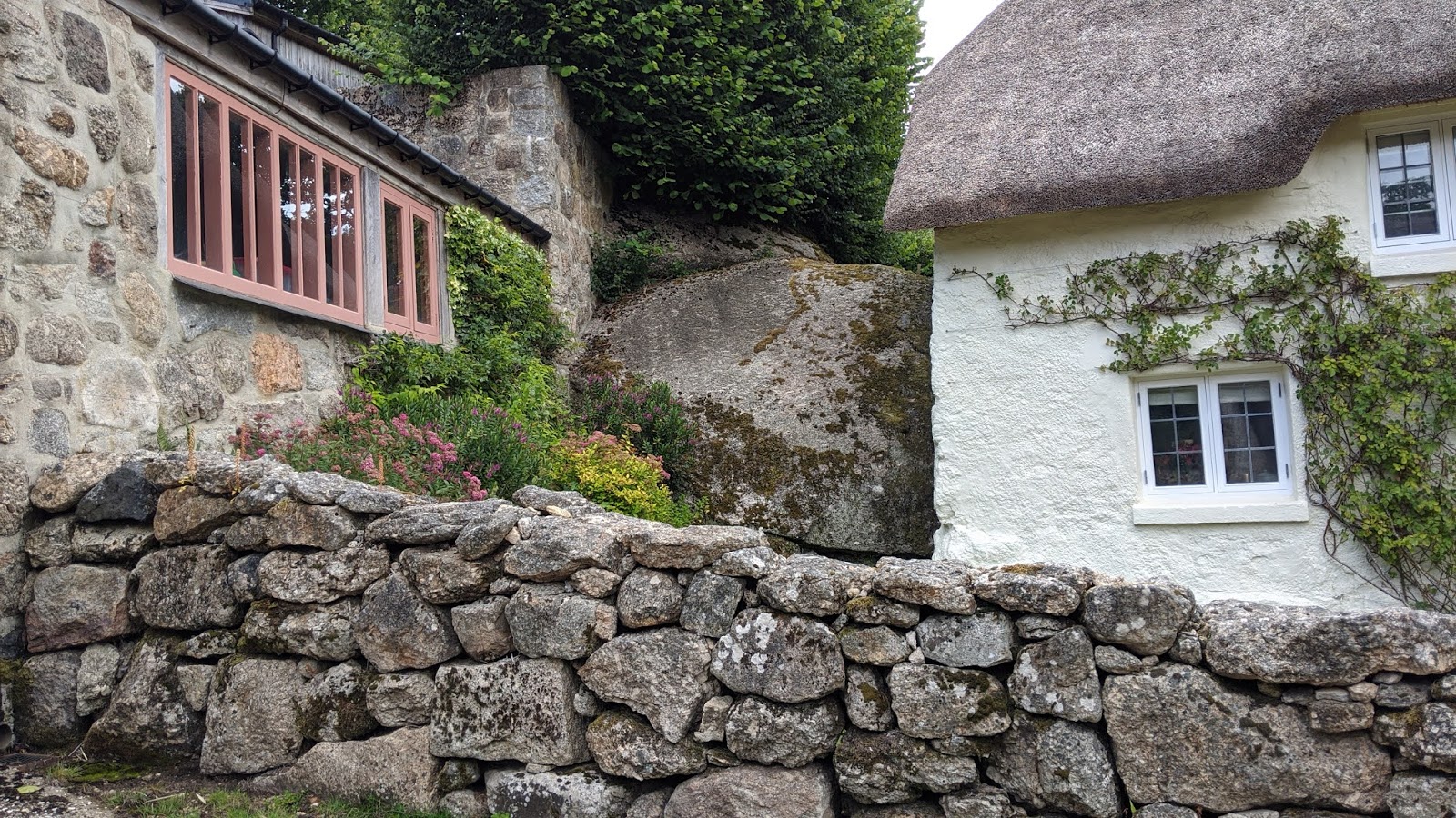
I think Paul was quite shocked by the number of named rocks in this area, and I can't blame him; I still am every time I visit. If this area was a moorland, there wouldn't be as many named tors, but as it is, every garden has its own assortment of granite and it would seem churlish to group them all into one - even though they are all probably connected.
Pethybridge Rock was next up, and the final tor on this road before the next ascent. The tor, or 'rock', is easily accessible unlike the others which are in people's gardens and residences.
 |
| Pethybridge Rock noted by Steve Jenkins |
 |
| Pethybridge Rock |
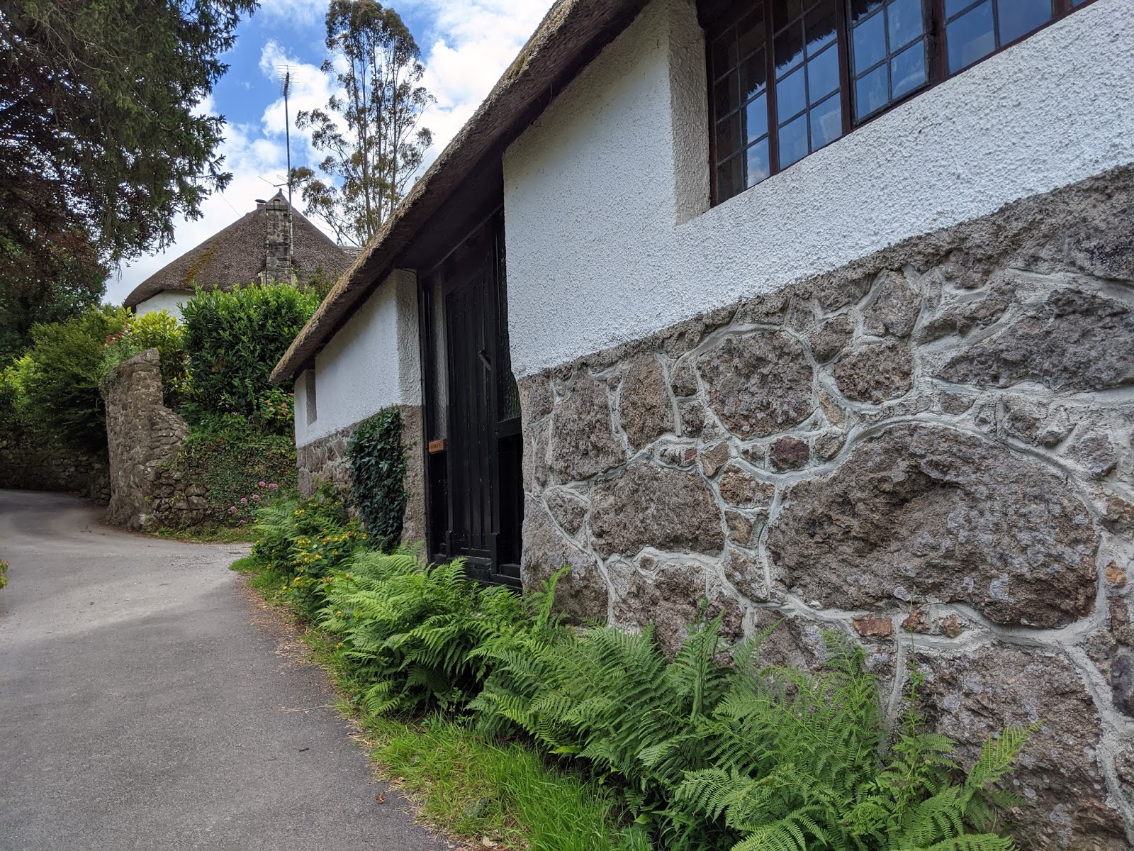
The road up through the beautiful hamlet of the same name twisted and turned where, halfway up, lay a bench where I decided to have my first drink of the day. I could've had one at Hammerslake like Paul did, but there was nowhere to sit. The bench was a lovely place to have a quick rest and refresh before arriving at our next tor.
I must admit it was nice to be showing off these tors to someone, as I usually walk Lustleigh alone where I can't share these awesome outcrops with anyone. It felt quite a privilege to be able to give Paul a tour of the area.
'The Cob Loaf' is a larger outcrop than I first remembered, and is well represented on
old OS Maps. The name comes from a local who I was talking to almost two years ago, the owner of the house next door called 'The Crags'. It makes sense for the owner of Cob Cottage to name the tor after it, or was it the other way around?
 |
| The Cob Loaf, a squat outcrop |
 |
| The Cob Loaf. As you can see, the outcrop continues down to the right. |
 |
| Wedged Boulder, Pethybridge SX 78042 81029 |
Exiting Pethybridge, passing a post box, we came across a trough containing silt.
 |
| Pethybridge Post Box SX 78024 81021 |
 |
| Pethybridge Trough SX 78010 80970 |
At a crossroads, we turned left down the hill to the entrance of Woodlawn and Parklands. Again, having seen the tor close-up three times before, I saw little need to do it again, and Paul seemed pretty content viewing it from the entrance.
 |
| Parklands Tor upper outcrops |
 |
| Parklands Tor upper outcrops |
 |
| Parklands Tor - the sign is proof! |
I figured we were ahead of schedule (not really) so I decided to add on some other tors.
We retraced back up the road to the crossroads to take the track to Heaven's Gate and Croft Tor. This tor is one of my favourites in the Lustleigh locality, but knowing Paul would be much quicker I decided not to go through the narrow gap this time; I'd done it twice before and seen the tor three times prior, so I was happy to not bother. That was a good decision because I only had to blink and Paul was there waiting for me!
 |
| Croft Tor noted by Tim Jenkinson |
 |
| Croft Tor |
 |
| Croft Tor |
We entered Hisley Wood where we eventually took a small track up left into the woodland proper to find Higher Hisley Tor, a grand tor noted by Steve Jenkins. In actual fact, I would say it's among the top 5 LKTs.
 |
| Paul Rendell explores Higher Hisley Tor |
 |
| Higher Hisley Tor |
 |
| For a bit of context... Paul amid the huge rocks of Higher Hisley Tor. |
It was obvious that from here to Westhill Rocks someone had been tor bagging here recently, since there were fairly deep footprints, much larger and conspicuous than I could produce.
I named the tor as 'Westhill Rocks' taking the name from Tithe Maps.
 |
| Westhill Rocks |
 |
| Westhill Rocks |
 |
| Westhill Rocks |
A bit of a scramble down to the track involved crossing a sunken lane, but it was not terrible going considering it was summer. It was an enjoyable descent to Hisley Bridge, a stunning ancient packhorse bridge with a fantastic slotted gatepost at its south side. There is also a ford here.
However, before stopping here for lunch, we passed through a gate to reach Old Manaton Road, on which resides the 'Pudding Stone', a rounded granite boulder inscribed on it an OS Bench Mark. I forgot to obtain an NGR - silly me.
 |
| Ford at Hisley Bridge SX 77981 80032 |
 |
| Slotted Gatepost at Hisley Bridge SX 77983 80001 |
 |
| The Pudding Stone |
 |
| The Pudding Stone B.M. |
Paul directed me to two conveniently placed benches beside the Bridge where, just as I sat down to eat a banana and have a drink, I heard my name but, without my glasses on, I couldn't see who it was until he walked over and said his name. It was Nigel Machin who I also by chance bumped into at Grimspound last December. For that blog post, see
here.
 |
| Nigel on Hisley Bridge |
 |
| Nigel at Hisley Bridge Ford |
Saying our goodbyes, Paul and I took the most wonderful stroll through the beautiful meadow at the bottom of Rudge Wood. I would highly recommend this stretch of river between Hisley Bridge and Pullabrook Car Park for those who don't want hills or simply cannot walk them; it is such an enchanting stretch of the Bovey with an abundance of wildlife to see with the odd but of uneven ground.
 |
| Path through Rudge Wood, owned by East Dartmoor National Nature Reserve |
 |
| Welcome to East Dartmoor National Nature Reserve |
Onto the road, but only briefly, Paul was keen to show me one of his finds: Wood Hill Rocks at SX 78828 80241, a modest mound of metamorphic rock in a small copse near Drakeford Bridge. The name is sourced from Tithe Maps once again, and indeed this is a wood on a hill; it fits.
That said, I don't think they are good enough for the tor bagging list, mine included.
 |
| Wood Hill Rocks |
 |
| Wood Hill Rocks |
 |
| Wood Hill Rocks |
 |
| Paul at Wood Hill Rocks |
We left the copse when I received a text from Mum saying that she had left to pick me up in Lustleigh. Little did I realise prior to this how it was nearing pickup time so, unfortunately, the decision was made to miss out the tors in Higher Knowle Wood - a shame, yes, but it's a reason to revisit the area.
Over Packsaddle Bridge and into Knowle, passing Stondtorre, Paul noticed a Bench Mark on a granite post, one I cannot find on any old OS Maps at SX 78950 80866. Perhaps this is a moved gatepost?
 |
| Packsaddle Bridge |
 |
| Stondtorre |
 |
| Stondtorre |
 |
| B.M. Not on Map, Knowle SX 78950 80866 |
 |
| B.M. Not on Map, Knowle SX 78950 80866 |
We entered Wrayland (also spelt 'Wreyland') which, like Pethybridge, is strewn with cottages and dwellings.
 |
| Middle Wreyland |
 |
| Wreyland |
 |
| Wreyland Trough SX 78775 81196 |
 |
| Old Railway Bridge, Wreyland SX 78569 81217 |
We soon entered the village centre again, noticing the Village Cross that
Dartmoor Crosses describes as; "
...a fine Maltese cross, set on a double octagonal pedestal, topped off with rounded slabs. Incised around the top of the upper pedestal, immediately below the plinth, are the words 'IN PIOUS MEMORY OF HENRY TUDOR RECTOR OF THIS PARISH'."
 |
| Lustleigh Village Cross |
Before departing, we visited the Bench Mark on the fine church, B.M. 295.6 at SX 78486 81276.
 |
| B.M. 295.6, N facing, Lustleigh Church SX 78486 81276 |
 |
| B.M. 295.6, N facing, Lustleigh Church SX 78486 81276 |
 |
| Lustleigh Church |
I left Paul, thanking him for the excellent walk which, as is the case on most walks, had its ups and downs, before heading up the road to the War Memorial and view of Lower Mapstone.
 |
| Lustleigh War Memorial SX 78520 81355 |
 |
| Lower Mapstone |


No comments:
Post a Comment