 |
| Erme Head |
This walk was perhaps a bad idea given that the Met Office had forecasted rain and wind, but it had been in the planning for a couple of weeks and neither of us wanted to cancel - that is, me and
Paul Rendell.
Paul arrived early to pick me up at my place and we set off to Lud Gate, parking between the gate itself and Cross Furzes. As we began the gentle ascent to Lud Gate, first passing the entrance to Hayford Hall, we realised we were in for a treat with very strong winds and drizzle.
 |
| Hayford Hall |
 |
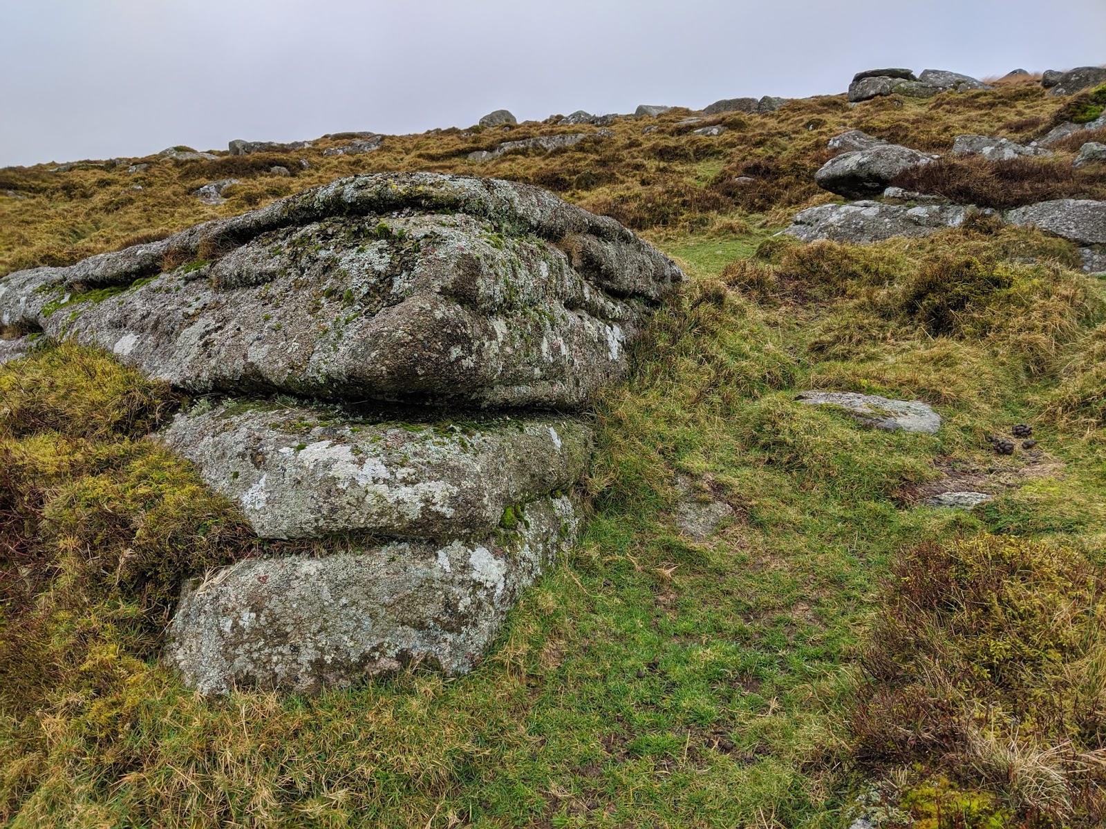
| Lud Gate |
Our route now took on a steeper ascent which wouldn't have been half as bad had the wind not been in our faces for the whole way up! It kept on pushing us back so we had to work twice as hard to make progress, but all was well when we noticed what is believed to be the 'Lone Piper' Boundary Stone which, like all artefacts on this walk, is listed on
Dartefacts where you can obtain an NGR if you become a member.
 |
| Lone Piper or is it? |
 |
| Lone Piper or is it? |
We came over the crest of the hill where we began descending to the Western Wella Brook - a sigh of relief as the wind was less deadly down here. Crossing the fine bridge at the upper ford we made for Huntingdon Warren Farm, a derelict farmstead that resides in an area where people would build pillow mounds to attract rabbits which, at the time, were people's main source of protein. I'm not very educated on this topic so if I've missed something/said something that's incorrect then please leave a (nice) comment!
Also near the farm is a memorial cross.
 |
| Huntingdon Warren Upper Bridge... is it a clapper? |
 |
| Huntingdon Warren Farm |
 |
| Huntingdon Warren Farm |
 |
| Huntingdon Warren Cross... not to be confused with Huntingdon Cross which we visited later on. |
 |
| Huntingdon Warren Cross |
Given we were already at an elevation of about 450m I suggested to Paul that we summit Huntingdon Hill and do the walk anticlockwise. He agreed, but en route to the summit cairn we encountered a good deal of scattered granite which we deduced were the remains of a tor. I wasn't particularly impressed but there was enough on the ground to warrant a name, that name being Huntingdon Rocks at SX 66318 66772.
 |
| Huntingdon Rocks |
 |
| Huntingdon Rocks, Paul Rendell atop |
 |
| Huntingdon Rocks |
The summit of the hill was visible, its huge cairn marking the very top at 478m above sea level. This is known as the Heap of Sinners or Huntingdon Barrow, and rather condense how this manmade structure gained its name I'll direct you to Tim Sandles'
Legendary Dartmoor site.
 |
| Heap of Sinners or Huntingdon Barrow |
 |
| Heap of Sinners or Huntingdon Barrow |
We took the track down the east side of Huntingdon Hill passing a couple of diminutive outcrops before reaching a tinners' hut known by the name of something house (when I remember the name I'll update this post).
 |
| Paul finds a letterbox |
 |
| Tinners' Hut near Heng Lake Broadafalls |
Now we would face the greatest challenge of this walk barring the weather: crossing the River Avon at Broad(a) Falls. Having tried and failed to cross here before (blog post
HERE), I was quite nervous about the idea. I followed Paul upstream first handrailing a fence and even past it, but realising there were no rocks above the water level and that Ryder's Mire was only a short distance away made us head back downstream and forge our way to the other side of the falls.
Easier said than done, though, as I didn't feel comfortable crossing where Paul did, so I continued further downstream crossing several slippery boulders and I did require a bit of help from Paul at the last moment to make it across safely. A big thanks to him!
 |
| Heng Lake Broadafalls |
 |
| Heng Lake Broadafalls |
 |
| Heng Lake Broadafalls |
 |
| Heng Lake Broadafalls |
We exited the gully as quickly as we had entered it and we now battling fierce wind and drizzle as we progressed to Red Lake Spoil Heap. I had no intentions of climbing to the top again, and neither of us did since we were more focused on finding our next outcrop: Wollake Tor.
Wollake Tor involved a beeline which wasn't as simple as it sounds. For starters, it can't be seen from the east side so we were basically heading in the rough direction of it, GPS-ing it of course as I'm lazy and the tor isn't marked on OS maps. This, in turn, involved bog hopping through bubblewrap grass (I've invented this term for grass that isn't high but is laid out in a grid-like pattern).
 |
| Red Lake Spoil Heap |
 |
| Bog Hopping near Dry Lake Head |
 |
| Boulders beside the Dry Lake |
I was pleasantly surprised with Wollake Tor. First noted by Steve Jenkins as seen on the
Tors of Dartmoor database it is a low outcrop, but it possesses a type of character that many small outcrops seem to have.
 |
| Wollake Tor |
 |
| Wollake Tor |
 |
| Wollake Tor |
 |
| Wollake Tor |
Black Rocks (Crossing) was next up. Why it has 'Crossing' in brackets is down to the fact that William Crossing and Eric Hemery seem to place Black Rocks in different places: the former on the left bank of the river at Phillpott's Cave while the other the right bank. Please see
Tors of Dartmoor for the quotes.
 |
Black Rocks (Crossing)
|
|
 |
Black Rocks (Crossing)
|
|
 |
| The Entrance to Phillpott's Cave |
|
 |
| Black Rocks (Crossing) |
|
We were expecting an easy crossing of Blacklane Brook which is also known as the 'Wollake', but boy were we wrong! It was quite deep which meant we had to look further upstream. I chose the ford and as my feet were already wet I hardly cared about getting them wet, but Paul, on the other hand, leapt from one side to the other!
Black Rocks (Hemery) were better than I was expecting, nothing huge but still a fine cluster of modest boulders in this beautiful valley.
 |
Black Rocks (Hemery)
|
|
 |
Black Rocks (Hemery)
|
|
 |
| Black Rocks (Hemery) with Black Rocks (Crossing) on the right |
|
 |
| Black Rocks (Hemery) |
|
Grant's Pot had to be visited whilst we were here, but I didn't go in as I hate claustrophobic places!
 |
| Grant's Pot |
 |
| Paul enters Grant's Pot to take a photo |
Another beeline was required to reach the A Head Stone, but we somehow ended up slightly north-east of where this is at Erme (or Arme) Head itself. Get in! I love visiting the heads of Dartmoor's rivers because it gives you a great sense of achievement to say that you've been at the source of where a pretty long watercourse starts. Now, of course, there are two things to note with this particular source: 1. being that OS maps incorrectly mark it as being south of here and fail to represent the actual source, and 2. being that the Blacklane Brook is the most distant source but to my knowledge that has never been called the Erme.
I recorded the source to be 447m above sea level at SX 62095 67348.
 |
| Erme Head |
 |
| Erme Head Peat Bank |
 |
| A (Arme) Head Stone |
 |
| A (Arme) Head Stone |
A little to the west lay Broad Rock, the furthest west we were going today and a sign that we were going to start heading back - not that I wanted to as I was having a good time.
 |
| View from Broad Rock |
 |
| Broad Rock Inscription |
 |
| Broad Rock |
 |
| Broad Rock |
Taking the south-easterly track we entered Erme Pits, a strange area strewn with granite and tinners' workings but a wonderful spot nonetheless. This is where we had lunch; for me a banana.
The Pits may not be as impressive as Chaw Gully or The Henroost but there is still a decent amount of exposed granite here, which, according to Paul, is known as 'Erme Pits Rocks' at SX 624 668.
 |
| Erme Pits Banana |
 |
| Erme Pits Rocks |
 |
| Erme Pits |
 |
| Erme Pits Rocks |
The rocks continue to the east where we entered a smaller gully at SX 62606 66821. Near here can be found what is known locally as the 'Table Stone' or at least where the locals place it at SX 62616 66748.
 |
| Erme Pits Rocks |
 |
| Erme Pits Rocks |
 |
| Table Stone |
From here we picked up a great little track to our next bag, a disappointing one called Dry Lake Rocks.
 |
| Dry Lake Rocks |
 |
| Dry Lake Rocks |
 |
| Dry Lake Rocks |
Our last bag of the day would be a small mound of rock known as the 'Cracker Stone'.
 |
| Cracker Stone |
 |
| Cracker Stone |
 |
| Cracker Stone |
 |
| Cracker Stone |
Over Red Lake, a stream which I didn't mention crossing over earlier, we took on the slog up ot Crossways where we saw our first other humans of the day; what appeared to be three men out wild camping. There are a couple of Two Moors Way marker stones in this area, one of which is actually very new and was placed here by the Dartmoor National Park Authority a year ago. Read more about it
HERE courtesy of Dartmoor Magazine.
 |
| Two Moors Way Marker |
 |
Two Moors Way Marker
|
 |
| New Two Moors Way Marker |
We expected the descent down to the Huntingdon Warren Clapper Bridge a tough one, but it was actually OK and manageable with care. From the clapper we headed east to Huntingdon Cross and the new clapper bridge at Western Wella Brook only to notice that the plaque has been removed!! What a shame, it was a great reminder of those who helped make the project happen.
 |
| Descending to the River Avon |
 |
| Huntingdon Warren Clapper Bridge |
 |
| Huntingdon Cross |
 |
| The New Clapper Bridge with no Plaque... look on the right: you should notice a pale patch where it once was. |
I would say that the stretch from here over Hickaton Hill back to Lud Gate was the hardest stretch of the walk, not because it was at the end of the walk but because the wind must've been at its strongest. It didn't take long for the mist to arrive but it couldn't compare with the wind we were battling. Whilst we were walking into it in the morning the wind was now behind us and sideways, pushing us down an already slippery path where we passed a runner.
The only point of interest on this stretch was a trough pointed out by Paul at SX 67517 66938. I think we were both relieved to have made it back to the car in one piece at the end of this 12-mile walk. Once again I'd like to thank Paul for this company and for taking me to this part of the moor.
 |
| Millstone beside Path |


It was a great walk, it was tough with that wind and thanks for your company.
ReplyDeleteThanks again, Paul.
DeleteGreat area! Love the south moor! walking out of Lud gate takes me back to he school days in 1965 ish with my Duke of Edinburgh Awards (all 3 ) don't get up there as much as I would like, living in Cornwall now!! Great Pictures! Many Thanks! Richard Simpson.
ReplyDeleteThat's great information, Richard, and I hope you manage to get to the Lud Gate area again. Thanks for reading!
Delete