Legendary Dartmoor says that this ruin was the most remote and highest inn in the south-west, at 591m above sea level. This location makes one think of what it was like to dine at this secluded spot, with stunning views and quiet contemplation.
From here, I made my first mistake of the day. To prevent 'retracing my steps', I thought I'd do 'as the crow flies' to the corner of the peat pass. Whilst it's a shorter distance, the terrain is awful: thick, long grass with countless holes and drops.
Not only is this dangerous but I had to ensure I wasn't veering off the route. It was a painful 20 minutes according to my GPS; it felt much longer.
 |
| I hate this terrain |
I could see the corner of the peat pass where I was expecting to find a second Peat Pass Marker, however, I didn't expect it to be so far off the pass itself at SX 6201 8554.
 |
| Frank Phillpotts' Peat Pass Marker |
 |
| Frank Phillpotts' Peat Pass Marker |
Fortunately, the ground matched my GPS satellite imagery, with several 'good' paths heading around Walla Brook Head to the Quintin's Man to Watern Down track. It was respite at its best, but this unknown territory still had me checking 24/7 where I was.
 |
| Descending Whitehorse Hill |
Reaching the 'ridge path' between the two cairns, I headed north, in the direction of the cairn on Watern Down, bearing slightly left of it where the path was supposed to be. It wasn't obvious but the ground was very dry so I just plodded on.
 |
| Approaching Watern Down Cairn |
 |
| Watern Down Cairn |
Now despite being back in known terrain, I had a new tor to seek out, and one I've always walked above when trekking between Watern Tor and Down.
'Watern Down Tor' at SX 6297 8630 was first noted by Bob Fitzpatrick. It's an impressive emergent rock face protruding from the hillside, but it doesn't stand out from afar, especially when you have the beautiful Watern Tor 400 metres northward.
 |
Watern Down Tor
|
|
 |
Watern Down Tor
|
|
 |
Watern Down Tor
|
|
 |
Watern Down Tor
|
|
 |
| Watern Down Tor |
|
 |
| Watern Down Tor |
|
| |
From this tor you can actually spy Watern Tor, or at least its highest outcrop. I bloody love this tor, and as of this, my 5th visit, I can comfortably say it's my favourite tor ever. I had my 3rd break here, which took me by surprise as my last break was at Little Wild Tor, some 1 hour and 45 minutes' ago.
 |
| Watern Tor |
 |
| Watern Tor |
 |
| Watern Tor |
 |
| Watern Tor |
During the pause, I heard voices, only to discover I was sharing the tor with about 10 kids and 5 adults. I was horrified and took to Facebook to share my thoughts! Only now did I realise my Power Bank was on its last bar, almost out of charge, and my phone was at 33%. I panicked and stuffed both objects into my pocket to pray that the phone would charge and the battery would last. To keep a pictorial record, I grabbed by underused Canon camera.
I quickly bagged 'The Thirlstone' and rushed off down the hill, finding the track shown on my GPS to the Walla Brook.
 |
| 'GP' (Gidleigh Parish) on The Thirlstone |
 |
| The Thirlstone |
I didn't enjoy the descent from the tor at all, but I had little choice in order to reach a succession of new bags en route: Rippator or Rival Tor coming next.
The path was alright, disappearing every now and again, but I did eventually arrive at the brook after clambering down the steep right bank through tussock grass.
 |
| Wild Tor Clitter as seen from Watern Tor slopes |
 |
| The Walla Brook |
 |
| The Walla Brook, where I crossed and almost slipped |
 |
| Walla Brook, where I crossed and almost slipped |
A narrow path loosely follows the Walla Brook's left bank, which I took until I reached a 'perfect camping spot' listed on Dartefacts at around SX 6389 8742.
I skewed left onto a better-defined track to two fords, the second presenting as a deep ford.
 |
| Track to Gallaven Ford, Rival Tor top left - my next stop |
 |
| Gallaven Ford |
Across that, I found a sheep track to the fine but small Rippator or Rival Tor. Literally smothered in sheep poo, the tor offers great views of the infamous mire below, and also across the Watern and Wild Tors that I visited earlier. I had my fourth break here and was pleased to report my phone had reached 55% battery - so I could put the Canon away.
 |
| Rippator or Rival Tor |
 |
| Great views from Rippator or Rival Tor |
 |
| Rippator or Rival Tor |
Leaving this lonely tor I headed north, unintentionally parallel to the path I should've been on. Reaching the main track around Kennon Hill on its south side, I turned right, finding myself amid thick gorse as there were more cows! The 4th lot of this walk!
 |
| Calves |
I had to take another shortcut as I was being 'eyed' by about 20 cows, naturally protecting their calves from 'afar'. I was expecting my next checkpoint to be a bit more conspicuous than it turned out to be! The Buttern Hill Stone Circle is a bit disappointing for me but at least I can tick it off.
To say I've walked the crescent, I only have the Sittaford Tor Stone Circle left to visit.
 |
| Buttern Hill Stone Circle |
 |
| Buttern Hill Stone Circle |
 |
| Buttern Hill Stone Circle |
 |
| Buttern Hill Stone Circle |
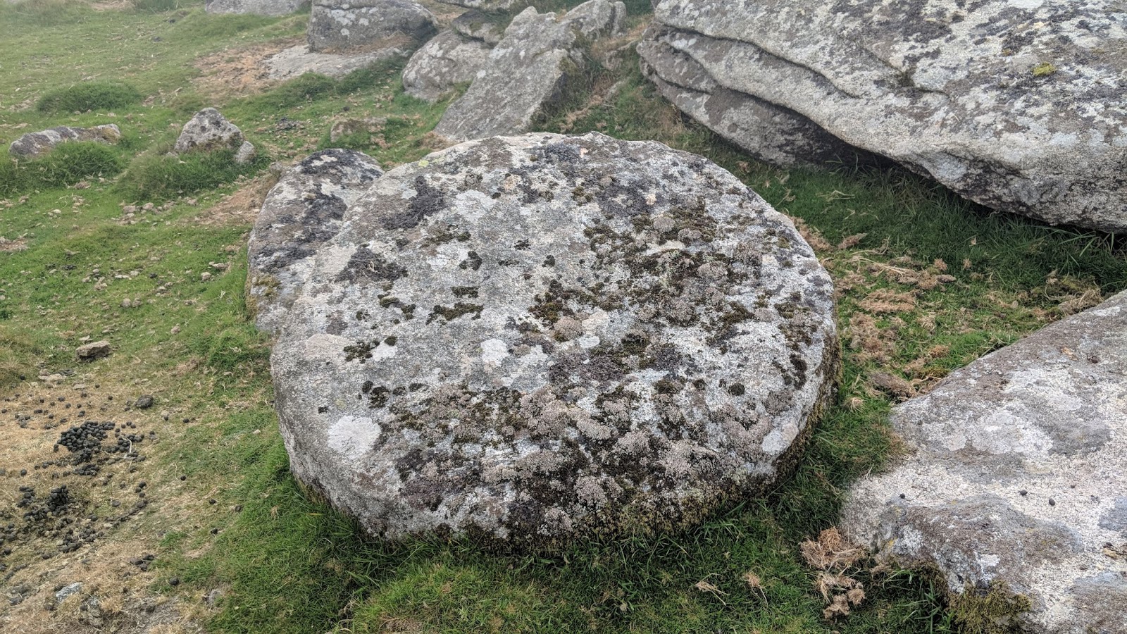
From here, I ascended up the hill of the same name, well ahead of time, to the fascinating Buttern Rocks or Tor. Why I find the area so interesting is down to what's on the ground: at the southern end of the rocks at SX 65287 88652 there is a fine logan stone, and another can be found at SX 65278 88694; the appearance of the rocks resemble a castle ruin, albeit a lowly one; at the main mass there is a millstone (SX 65276 88699) and directly above this, a very fine tethering ring (SX 65279 88703).
 |
Buttern Rocks logan stone 1
|
|
 |
Buttern Rocks millstone
|
|
 |
Buttern Rocks logan stone 2
|
|
 |
Buttern Rocks logan stone 2
|
|
 |
Buttern Rocks
|
|
 |
Buttern Rocks tethering ring
|
|
 |
| Buttern Rocks |
|
 |
| Buttern Rocks |
|
The name of 'rocks' perhaps sounds better as there are some mediocre outlying outcrops north of the main mass, at SX 6522 8885.
I made for the wall to reach a small outcrop shown on
Google Satellite Imagery. It wasn't a diversion so I thought I'd check it out. What I found was a lump of granite dissected by a wall, and on stepping up to it, I spotted a very fine rock basin. A wire fence prevents cattle from scratching it would seem on the other side, so technically all of the tor is on public land.
Pleased with the find, I dubbed it 'Little Buttern' at SX 6536 8920. The full write-up can be viewed
HERE.
 |
| Little Buttern, showing a gate |
 |
| Little Buttern |
 |
| Little Buttern. A rock basin is revealed! |
 |
| Little Buttern rock basin |
 |
| Little Buttern and the wall and gate |
I basically followed the wall and then the hedge near Buttern Farm to reach the lane to Shilstone. I strolled up the road, hitting the 13-mile mark to Shilstone Tor's 'mini' car park, and all that was required was a 5-minute wait for the family on a convenient bench.
 |
| Road to Shilstone |
Shilstone Tor is a poor tor for me, despite its unique cave and feather and tare marks. It just didn't excite me and it's too public.
 |
| Shilstone Tor |
 |
| Shilstone Tor cave |
 |
| Sam's found a letterbox |
 |
| Moss on Shilstone Tor |
All in all this was a successful walk, with interesting terrain and tors. I would still have to say my favourite part had to be the Wild Tor Ridge section, wedged between the beautiful Steeperton and Watern Tors.


No comments:
Post a Comment