 |
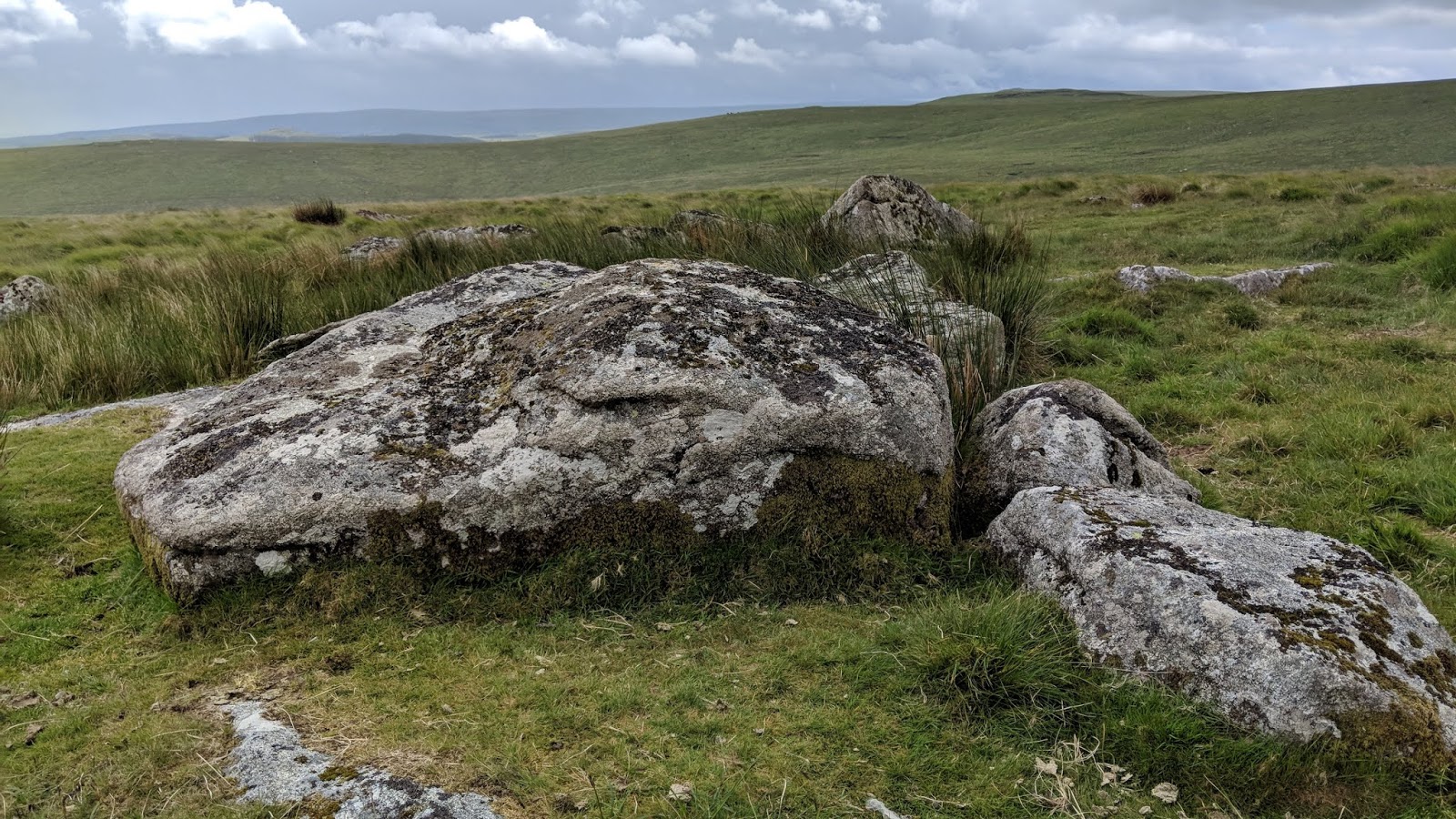
| Broken Tor and Tim at the elongated outcrop |
It feels quite surreal to say that this walk has meant that I have bagged every named tor between Gidleigh on the North Moor and Cornwood on the South Moor, barring one which isn't even named - yet! But it looks too good to be forgotten about, residing at SX 623 780 below Higher White Tor. I still have a long way to go, but to be able to say I've done a large patch is a great feeling, and long may it continue.
Tim Jenkinson arrived in Abbotskerswell to pick me up promptly at 08:30am and we drove to Postbridge, one of my favourite places on Dartmoor, being both a place of memory but also because of how well centralised it is on the moor.
We parked in the visitor centre car park beside a small rock: Postbridge Rock! Of all the tors we visited today, Hartland is the only one marked on OS Maps; the remaining seven are not.
 |
| Postbridge Rock |
We began the trek as we did for Fur Tor (link
HERE for Part 1), past some erratic cows that a farmer, I presume, was trying to guide into the right field.
Onto the moor proper, we first revisited Roundy Park Rocks, a fine small tor overlooking the famous cist below with a double capstone.
 |
| Roundy Park Rocks |
 |
| Roundy Park Rocks |
Minutes later, we arrived at Braddon Lake Ford, a bit deeper than last time and very wet underfoot. Braddon Lake Rocks are also found in this spot.
 |
| Braddon Lake Rocks |
Broadun is one hell of a slog, and as usual, I was trailing behind. It hadn't helped that I'd been stuck indoors for a solid month, and it was showing in my fitness. I just tried to forget my weaknesses and focus on my strengths, eventually catching up to Tim at the stile in front of Broadun Rocks (east).
This is a small, low tor that was previously missed on our Fur Tor expedition. It is a pleasant place to take a quick rest after ascending the hill.
 |
| Broadun Rocks (east) |
 |
| Broadun Rocks (east) |
 |
| Grand views from Broadun Rocks (east) |
 |
| Broadun Rocks (east) |
A bit of descent eastward was necessary to reach Broken Tor, a stupendous broken (hence the name) ridge of granite extending northward for some 300+ metres to above the East Dart River's right bank. Unnamed and poorly represented on all maps, Tim believes he was the first to give it any credit; an article in Dartmoor Magazine 128 Autumn 2017 explains this bizarre omission.
Who better to have as a guide than Tim who first showed me the large southern section, at SX 6380 8080. It's awesome and intimidating below the huge wall of granite, and, a little further to the north of here, a small cave can be used as a shelter from strong winds and/or rain.
 |
| Broken Tor |
 |
| Broken Tor |
 |
| Broken Tor |
 |
| Broken Tor huge buttress |
 |
| Broken Tor |
 |
| Broken Tor inside the mini cave |
But it doesn't stop there, as the middle section possesses a fine stack. Just above this is a dilapidated cairn where we left the tor, still with much of the northern section unexplored, though it doesn't seem that impressive compared to what we've just visited.
 |
| Broken Tor stack, looking up to White Ridge |
 |
| Cairn above Broken Tor |
We stumbled across a faint track which took us down to where we wanted to be beside: the East Dart. We needed to find a way to cross this river to reach our next bag, but it was easier said than done. The valley side here is steep and vertical, but fortunately, the glen is stunning with the odd outcrop protruding from the hillside; a couple of trees also add character and at one point, the river splits briefly to form a grassy island.
 |
| Outcrop above the river |
 |
| East Dart River |
Keeping in mind how slippery the rocks could be, we chose a sensible crossing place, just past Nameless Tor on the opposite bank. Tim went first, successfully leaping the last section. My fears of river crossings have changed little since Ten Tors Training, but I got as far as the leap section, throwing my poles across. I had a decision to make: leap with the rucksack which means more weight to lift, or pass the rucksack to Tim with some chance of flying across the water?
I chose the latter but taking off my rucksack in the middle of a river with no support was dangerous, as was trying to lean over the river so Tim could grab it. Tim's rucksack is tiny so he had no trouble leaping across, but me, mine is heavy for some inexplicable reason. Luckily, Tim has a strong hand and good balance as he took the rucksack off me.
Now, all I needed to do was a jump, not gracefully but so I could make it out alive. My feet were already wet from crossing the middle portion of the river (as I couldn't get down on the ground!), however, this section was particularly deep so I forgot my fears and leapt and forced myself onto the grass, doing a bonus roly-poly.
It was successful and prevented the need to divert to East Dart Falls.
 |
| Where we crossed the East Dart |
Up to the right is Nameless Tor, another grand lesser known tor described by Eric Hemery in High Dartmoor p.540; "
The side of Broadun above the right bank of the defile calls for little comment; the opposite side, however, the south foot of Winneys Down, is distinguished by several features. One of these is a rock-field extending from the hillside above the steep to the very brink of the river bank and headed by a nameless and disintegrated tor - the best place to obtain a close-up view of the river passing through the defile. Shallow caverns here result from frost partings, one of the largest cradling a tree. Above the ruined tor is the most unusual and striking of the features - a granite 'pavement'."
 |
| Nameless Tor |
 |
| Nameless Tor |
 |
| Tim at Nameless Tor |
 |
| Nameless Tor deep cave |
 |
| Nameless Tor |
 |
| Nameless Tor granite pavement |
The tor is also dissected by a dry leat - what I presume is the Birch Tor and Vitifer Mine Leat, but there is another leat contouring the hillside just above this, running parallel.
Tim lead me to Winney's Down Logan Stone at SX 6262 8144, a superb logan stone indeed. It resembles a fish, a frog and a lizard from certain angles. I chose to have a snack here whilst Tim investigated a curious rock above Sandy Hole Rocks (south) - a lone rock that is part of a hut circle at SX 6237 8136.
 |
| Sandy Hole Turf Topped Rock - pic by Tim Jenkinson |
 |
| Nosey sheep on Winney's Down zoomed from the logan |
 |
| Winney's Down Logan Stone |
 |
| Winney's Down Logan Stone |
 |
| Winney's Down Logan Stone |
 |
| Winney's Down Logan Stone |
From here, we headed east in the hope of reaching Lade Hill Tor before the rain, which was visible over at Cut Hill, settled in. In doing so, we came across some outliers at SX 62720 81440. Very lowly.
 |
| Granite on Winney's Down |
 |
| Granite on Winney's Down |
This is where it gets interesting and scary: whilst trudging through the tussock grass I realised my phone had fallen out of my pocket. Uh oh, what do I (we) do? I immediately told Tim and we went looking. I was almost in tears - what idiot keeps their phone in their hoodie pocket? Well, me, prior to this event as my phone wouldn't really leave my side.
I headed away from Tim, in another direction, but this turned out to be a mistake as he couldn't have been any more precise in his steps and he found it instantly, fortunately resting in a patch of low grass whereas it could've fallen into a bush. Lesson learnt, keep your phone in a zipped pocket if you don't already. This could've been a much worse ending. Thanks, Tim.
Fording Winney's Down Brook near its source was simple but we lost the track ascending Lade Hill - even though it was obvious from afar.
 |
| Winney's Down Brook Head |
Lade Hill Tor is a striking tor purely because of its large rounded rock perched atop the tor, near the summit of the hill. Tim is the first to mention this, worryingly, and what's more the hill, which is well known in the literature, is not even named on maps!!! And yet when viewed from the south it is a beast, and just descending it like we did afterwards gives you a sense of its stature.
Whilst Tim had lunch, I explored the tor.
 |
Lade Hill Tor
|
|
 |
Lade Hill Tor
|
|
 |
Lade Hill Tor
|
|
 |
Lade Hill Tor
|
|
 |
| Lade Hill Tor |
|
 |
| Lade Hill Tor |
|
As we began descending the last bag of the day it started raining as expected. Tim and I sheltered beside the lower portion of the tor to put on our coats.
We passed a distressed sheep at one of the dry leats who was coughing their guts up. I almost rang
Karla at Dartmoor Livestock Protection. Surprisingly, the rain ceased but I still kept my coat on because knowing Dartmoor, this would only be a false alarm.
 |
| Tim descending Lade Hill. The heavens open. |
Near the river now, we turned left, through a gate towards Lade Hill Brook that is easy to ford. Across this, we made for the quaint Beehive Hut.
 |
| Gate at the bottom of Lade Hill |
 |
| Large boulder SX 63637 81441 |
 |
| Lade Hill Brook |
 |
| Lade Hill Brook |
 |
| Lade Hill Brook Ford |
 |
| Tim at the Beehive Hut |
 |
| Beehive Hut |
We joined the Grey Wethers to Hartland Tor footpath and headed towards the latter. In doing so, though, we both decided to pay a visit to The Sheepfold, a place I hadn't been to before and somewhere Tim was keen to revisit.
John Hayward, in 'Dartmoor 365' (I11), tells us, "There are two traditions about the origins of this enclosure, which with its magnificent walls is unique on the moor."
"One says that it was built, perhaps in the early 19th century, as a factory where starch would be produced from potatoes to be grown in the vicinity. The two brothers who built it intended also to build a mansion - where Stannon Cottage now stands - but that plan came to naught, and the entire project folded up before ever any potatoes were grown."
"The other tradition is that the enclosure was built as a sheepfold, and included the now ruinous dwelling which is still evident at one end of the yard. The array of standing stones along the inside walls are the remains of sheep pens, once roofed over. This enterprise is attributed to the Scotsman who introduced Scottish Blackfaced sheep to Dartmoor. It is possible that he merely took over the abandoned site, blocking up the original wide entrance, and adapting the inside architecture to his own purposes."
Tim and I took our time finding an entrance as the large, rusty gate at the north-west end is padlocked. We found a way in at the south-west side, after passing through a metal gate adjacent to two granite gateposts.
 |
| The Sheepfold |
 |
| The Sheepfold |
 |
| Inside The Sheepfold |
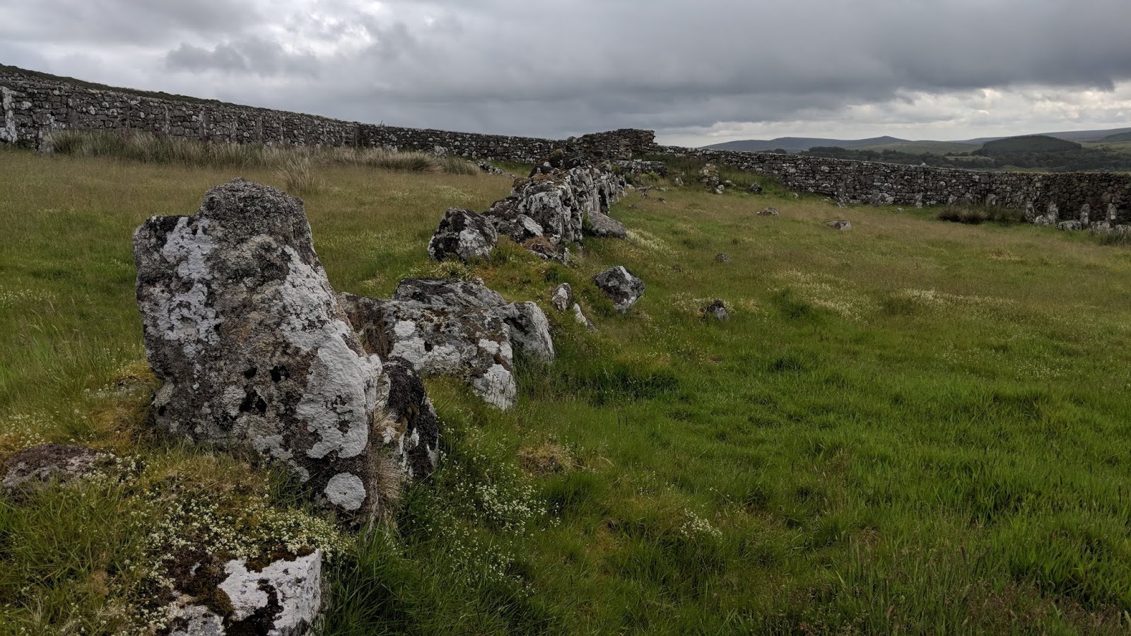
We followed the wall to rejoin the track but Tim wanted to show me a few boundary rocks, all located on or near to the newtake wall. This proved difficult, despite Tim and Mark Fenlon finding almost every single one some time ago. It felt like hours walking up and down the length of the wall; we did it at least 6 times!
I checked a rock on one side but found nothing, yet when Tim observed the other side he finally found a 'B', this one at SX 64072 80934.
 |
| Boundary rock |
 |
| Boundary rock |
 |
| Moss and lichen |
Over a stile, the grassy path widens and gives you the option to summit Hartland Tor or contour around its western side. We took the former as it's not steep and it's a lovely tor.
Here, the rain returned so we sought shelter as soon as possible.
 |
| Tim on Hartland Tor |
 |
| Hartland Tor |
 |
| Hartland Tor |
 |
| Hartland Tor |
 |
| Hartland Tor |
 |
| Hartland Tor sad face |
 |
| Seeking shelter |
The track from Hartland Tor to Postbridge has been improved and is much more enjoyable to walk now. At Hartyland, we took a short break as we were doing well for time.
 |
| Tim trying out the refurbished track |
 |
| Tree at Hartyland |
Then, we arrived at the 'new' bridge in Postbridge, noticing the dilapidated railings atop the bridge on both sides.
 |
| Tim at Postbridge Road Bridge |
 |
| Postbridge Road Bridge |
 |
| Railings removed |
Past Postbridge Stores we were back at the car park where we discussed the day, which, for a 7.5 mile walk was full of history, granite and views. A great day out.


No comments:
Post a Comment